How Smartphones Determine—and Reveal—Your Location
Smartphones can infer location through GPS, cellular towers, Wi-Fi, Bluetooth, motion sensors and account history. Here is how those technologies work and what they mean for privacy.
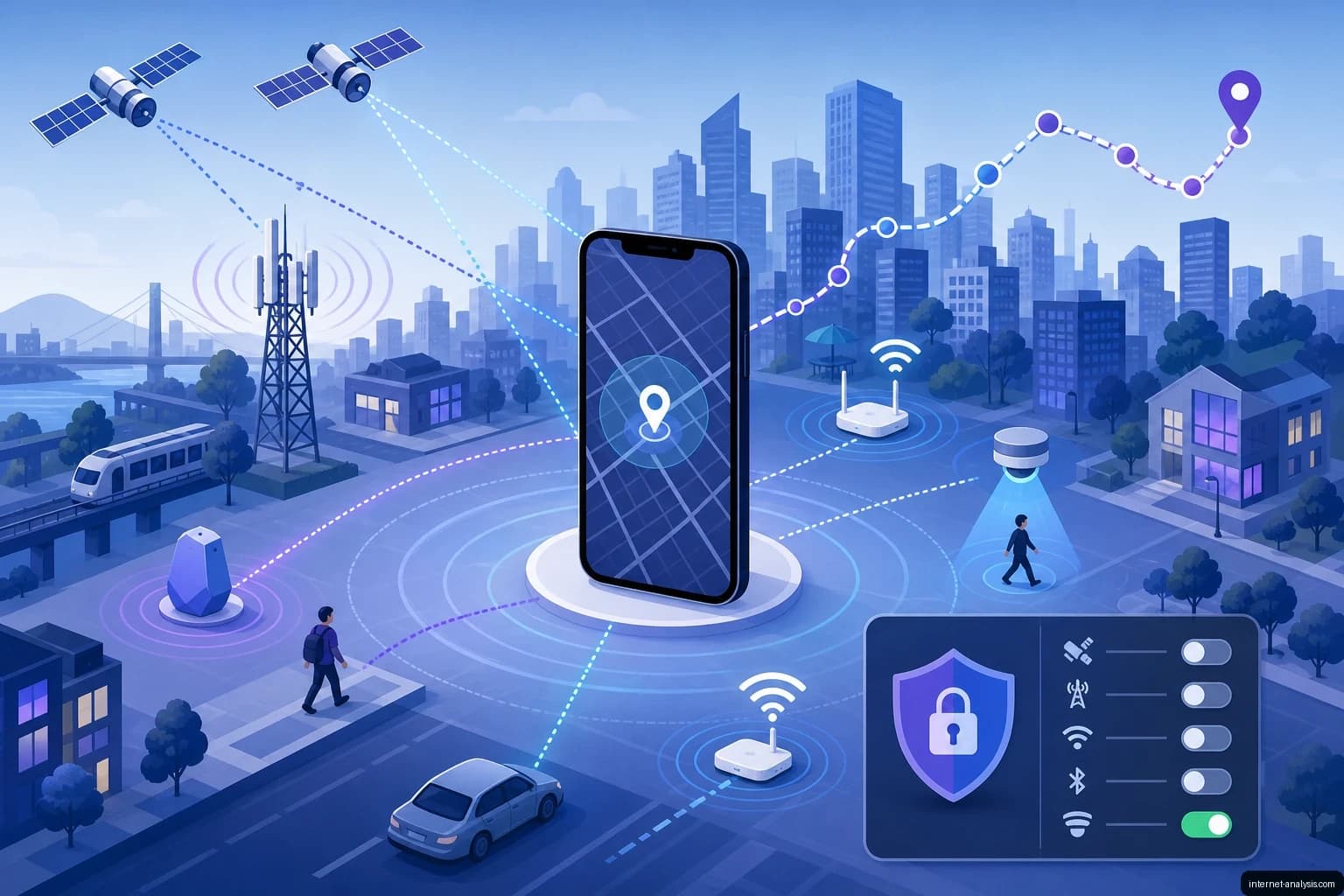
A smartphone does not need an active GPS signal to determine where it is. Cellular infrastructure, nearby Wi-Fi networks, Bluetooth devices and motion sensors can all contribute location data. Online services may then combine those signals with account activity and historical records to create a detailed picture of where a device—and often its owner—has been.
Understanding smartphone tracking therefore requires looking beyond a single setting or sensor. Location is usually the product of several technologies working together.
Cellular positioning: triangulation and trilateration
Every connected phone communicates with nearby cellular base stations. The network must know the phone's general area so it can route calls, messages and data. That relationship also makes cellular positioning possible.
The terms triangulation and trilateration are often used interchangeably, but they describe different methods:
- Triangulation estimates a position from the angles at which signals arrive.
- Trilateration estimates a position from measured or inferred distances to multiple known points.
In a GSM or other cellular network, measurements such as signal timing, signal strength and the identities of visible base stations can help estimate a phone's location. Using observations from multiple towers generally provides a better result than relying on one cell alone.
Cellular positioning does not usually offer the precision associated with a strong satellite fix, but it can continue working indoors or in dense urban areas where satellite signals are weak. The network operator also has access to information that an ordinary application may not.
How GPS calculates a position
GPS receivers listen for precisely timed radio signals broadcast by satellites. Because those signals travel at the speed of light, the receiver can use their arrival times to estimate its distance from each satellite.
Combining measurements from several satellites allows the phone to calculate its position. Four satellites are normally needed to solve for three-dimensional coordinates while also correcting the receiver's clock error.
A phone may take longer to obtain a position when it has a limited view of the sky. Buildings, roofs and other obstacles can block or reflect satellite signals. Smartphones compensate by using assisted GPS and other available location sources, including cellular and Wi-Fi observations.
How services locate a phone without GPS
Disabling GPS does not necessarily make a phone invisible. A device or online service can still infer location from several sources:
- Cell towers: The serving cell and neighboring towers identify the phone's approximate area.
- Wi-Fi access points: Nearby network identifiers can be compared with databases containing previously observed access-point locations.
- IP addresses: An internet connection can indicate an approximate geographic region.
- Bluetooth signals: Beacons and nearby devices can reveal proximity to a known place or object.
- Account history: Searches, navigation activity, photographs and prior device locations may provide additional context.
- Motion sensors: Accelerometers and gyroscopes can help estimate how a device has moved since its last known position.
Large location platforms can combine these inputs rather than treating each as an isolated measurement. A weak signal may become more useful when it is correlated with other observations and a device's history.
Wi-Fi positioning and wardriving
Wi-Fi positioning depends on databases that associate wireless access points with physical coordinates. These records can be built by devices that observe network identifiers while also knowing their own GPS positions. Some databases are open, while others support commercial location services.
The technical distinction between a network name and an access-point identifier matters. An SSID is the human-readable network name and may be shared by many networks. A BSSID usually identifies a particular access point or radio interface, making it more useful for positioning.
Wardriving is the practice of moving through an area while scanning for wireless networks and recording information about them, often with location coordinates. Although the technique can support research and network mapping, collecting or using wireless data may raise privacy, legal and ethical concerns.
Wi-Fi behavior can also expose identity. A device may automatically reconnect to a remembered network or otherwise interact with nearby infrastructure. In an investigation, an accidental network association can connect a device to a place, time or known user. Such a connection has been used as evidence when identifying vandals.
Bluetooth beacons and proximity tracking
Bluetooth is commonly used to determine proximity rather than exact geographic coordinates. A phone can detect a nearby transmitter, estimate relative signal strength and infer that it is close to a particular location.
iBeacon
iBeacon is a Bluetooth Low Energy beacon technology. A compatible transmitter repeatedly broadcasts a small identifier. An application that recognizes the identifier can respond when a phone enters or leaves the beacon's vicinity.
The beacon itself does not have to calculate the phone's location. It announces its identity, and the receiving application associates that identity with a place or action. Signal strength may provide a rough indication of distance, but walls, people, radio interference and device orientation can affect the estimate.
Apple's device-finding network
Apple devices and compatible accessories can participate in a crowdsourced finding network. A missing device can emit Bluetooth signals that nearby Apple devices detect. Those nearby devices can then relay location information through the internet so that the owner can retrieve it.
This design allows the missing device or accessory to be found even when it has no direct internet connection. The system still relies on another participating device to detect the Bluetooth signal and forward the report.
What the gyroscope contributes
A phone's gyroscope measures rotational movement. It can detect changes in orientation, such as turning, tilting or rotating the device. It does not independently provide latitude and longitude.
When combined with an accelerometer, compass and a previously known position, gyroscope data can support inertial navigation. For example, it can help estimate a change in direction when GPS reception is temporarily unavailable. Errors accumulate over time, so motion sensors are generally used to supplement rather than replace external positioning systems.
When crowdsourced location data can be manipulated
Location services often rely on observations gathered from large numbers of devices. That scale is useful, but it also creates opportunities for unusual device behavior to influence automated conclusions.
In Berlin, artist Simon Weckert demonstrated this effect by moving 99 phones together through streets. Google Maps interpreted the cluster of devices as slow-moving traffic and displayed apparent congestion. The project showed how a service's model of the physical world can be altered when its underlying sensor data presents a misleading pattern.
Location history and law enforcement
Stored location records can reveal more than a device's current position. Over time, they may show repeated visits, travel routes and associations with particular places. When those records are tied to an account, they can become sensitive evidence about an individual.
Technology companies may receive legal demands for user information from law enforcement. Requests can seek records connected to a known account or device, while location-based demands may ask for devices observed in a defined geographic area during a particular period. The availability and scope of any response depend on what data was collected, how long it was retained and the applicable legal process.
This makes retention as important as collection. A location observation that seems temporary can have different privacy implications when it is stored and linked with months of account activity.
Bluetooth exposure notifications
During the coronavirus pandemic, Apple and Google jointly developed a system intended to determine whether users had been near someone who later reported an infection. The approach used Bluetooth proximity signals rather than GPS location histories.
Phones exchanged rotating identifiers with nearby participating devices. If a user reported a diagnosis through an authorized process, other phones could check whether they had encountered relevant identifiers. The design focused on detecting proximity without requiring a centralized map of users' movements.
Reducing unwanted location collection
No single control disables every form of positioning. Users who want to limit tracking should review the complete set of services that can collect or infer location:
- Grant location access only to applications that need it.
- Choose approximate location when precise coordinates are unnecessary.
- Review whether applications may access location in the background.
- Inspect account-level location history and retention settings.
- Disable unnecessary Wi-Fi and Bluetooth scanning options.
- Remove unfamiliar applications and review their permissions.
- Consider whether photographs or other files contain location metadata before sharing them.
- Remember that cellular providers still need network information to operate a connected phone.
Smartphone location is not a single feature that can always be switched off. It is an ecosystem of satellite measurements, radio observations, network records, sensors and account data. Managing privacy effectively starts with recognizing how those sources reinforce one another.

Piotr
Network Performance Analyst at Internet AnalysisPiotr analyzes how download speed, upload speed, latency, jitter, and packet loss affect real-world connectivity. He translates test results into careful, reproducible explanations.
View author profile →How this article was prepared
Uses consistent metric definitions, excludes invalid samples where identifiable, compares medians rather than isolated extremes, and describes device, access-network, and geographic limitations. Writing approach: Measurement-led troubleshooting starts with an observable symptom and a precisely defined metric. Controlled comparisons change one variable at a time. Results, possible causes and the evidence needed to confirm them remain clearly separated.
Read our methodology →Reviewed by the Internet Analysis Editorial Team
Reviewed by the Internet Analysis Editorial Team · Updated August 13, 2026
Meet the editorial team →Article context, review and related questions
Smartphones can infer location through GPS, cellular towers, Wi-Fi, Bluetooth, motion sensors and account history. Here is how those technologies work and what they mean for privacy.
| Measure | Value | Context |
|---|---|---|
| Article type | Cybersecurity | Editorial classification |
| Reading time | 7 minutes | Estimated at approximately 220 words per minute |
| Editorial review | Internet Analysis Editorial Team | Updated August 13, 2026 |
| Review date | August 13, 2026 | Latest stored article update |
Methodology
Uses consistent metric definitions, excludes invalid samples where identifiable, compares medians rather than isolated extremes, and describes device, access-network, and geographic limitations. Writing approach: Measurement-led troubleshooting starts with an observable symptom and a precisely defined metric. Controlled comparisons change one variable at a time. Results, possible causes and the evidence needed to confirm them remain clearly separated.
Full methodology →Data freshness
- Page updated
- Data period
- August 13, 2026
- Responsible editor
- PiotrNetwork Performance Analyst
Primary sources
- Internet Analysis editorial methodologyReview and limitation rules
Limitations
- The article is informational and may simplify technical details for readability.
- Products, standards, prices and service availability can change after the review date.
- The latest review date does not guarantee that every external product or service remains unchanged.
Related questions
What is the main point of “How Smartphones Determine—and Reveal—Your Location”?
Smartphones can infer location through GPS, cellular towers, Wi-Fi, Bluetooth, motion sensors and account history. Here is how those technologies work and what they mean for privacy.
How was this article prepared?
Uses consistent metric definitions, excludes invalid samples where identifiable, compares medians rather than isolated extremes, and describes device, access-network, and geographic limitations. Writing approach: Measurement-led troubleshooting starts with an observable symptom and a precisely defined metric. Controlled comparisons change one variable at a time. Results, possible causes and the evidence needed to confirm them remain clearly separated.
When was this information last reviewed?
The latest stored review or update date is August 13, 2026.